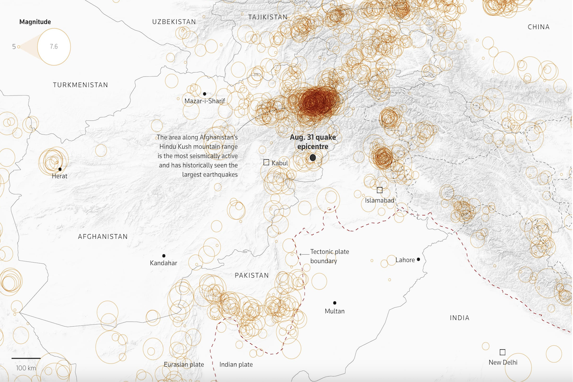
Reuters has created a map using U.S. Geological Survey data to show earthquake activity in eastern Afghanistan, one of the most seismically active regions in the world. Each circle represents an earthquake of magnitude five or higher recorded since 1950, with darker, denser clusters marking locations where earthquakes historically hit. The visualization highlights the Hindu Kush mountain range, where the collision of the Indian and Eurasian tectonic plates has historically produced Afghanistan’s deadliest earthquakes, including the magnitude six quake that struck near Jalalabad on August 31, 2025.
Observing Earthquakes in Afghanistan