
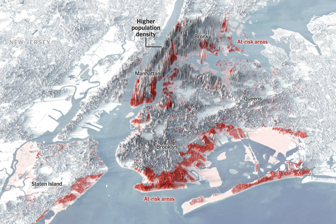
The New York Times has created a 3-D visualization showing New York City’s population density overlaid with areas at risk of flooding by 2080. Vertical bars represent population concentration—taller spikes indicate denser neighborhoods—while at-risk zones are highlighted in red across the urban landscape. The visualization reveals a stark problem: many of the city’s most populous areas, including Lower Manhattan, southern Brooklyn, and coastal Queens, fall directly within projected flood zones. According to the article, approximately 1.4 million New Yorkers currently live in areas that could face significant flooding by 2080. The visualization indicates that if flooding renders some regions uninhabitable, relocating residents within the city would be difficult, as the rest of the city is already densely populated.
Examining Flood Vulnerability in NYC
previous post