
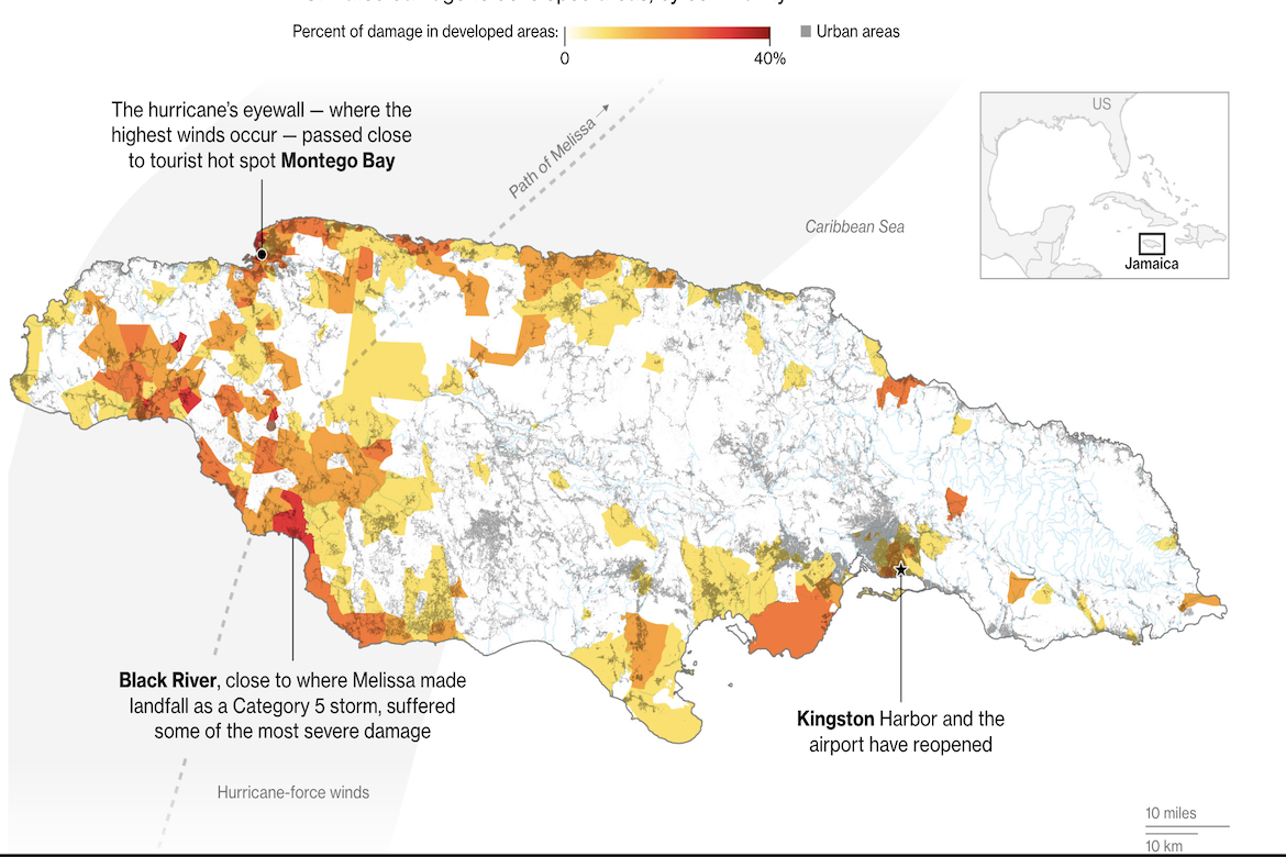
Bloomberg News has created a visualization mapping the extent of structural damage across Jamaica after Hurricane Melissa struck in late October 2025. Using satellite analysis, it estimates how much of each community’s built area the storm affected, with colors from yellow to deep red marking 0 to 40 percent destruction. Western towns such as Black River, where the storm made landfall, appear in the darkest shades, while eastern regions like Kingston show lighter impacts.
Mapping Level of Destruction in Jamaica After Hurricane Melissa
previous post