
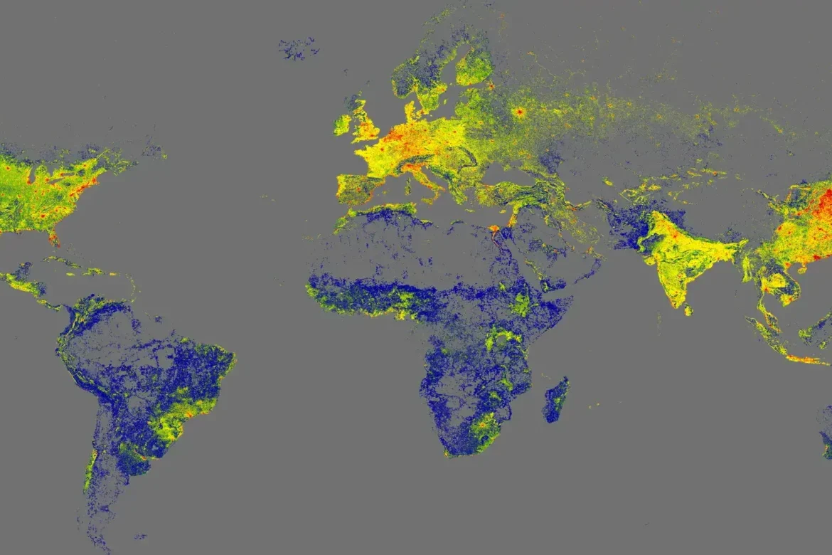
Researchers at the Technical University of Munich created the GlobalBuildingAtlas, a high-resolution 3D map of all 2.75 billion buildings on Earth. They used global satellite imagery and applied machine-learning models to identify individual building footprints and estimate their height from radar signals. The resulting 3D models are aggregated into a global map, where brighter colors show regions with dense, tall, and highly concentrated built environments, while darker areas highlight sparsely built or largely uninhabited regions—making clear how unevenly humanity’s physical footprint is distributed across the planet.
Capturing the World’s Built Environment
previous post