
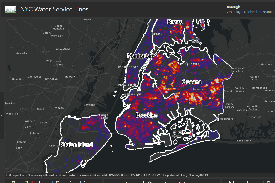
Non-profit environmental advocacy group, the New York League of Conservation Voters has created a visual that shows where lead pipes are located across New York City. The map uses data that water utilities submitted to New York state under the federal Lead and Copper Rule Revisions—a 2021 update that requires every utility to inventory the materials of its service lines—and shows where lines are classified as confirmed lead, confirmed non‑lead, or unknown. Areas with more confirmed and potential lead pipes appear in bright whites and oranges, while darker reds and purples indicate lower likelihood. The tool helps users better understand local water‑quality risks.
Revealing New York City’s Water Safety
previous post