
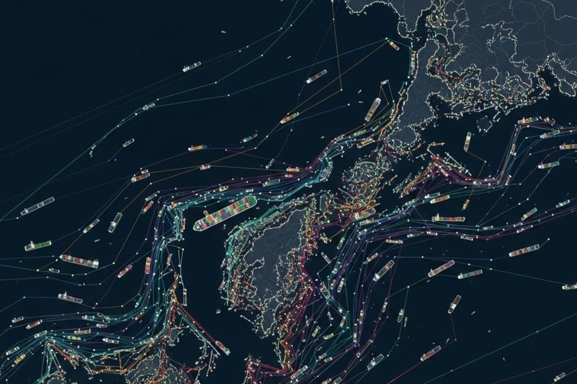
Japan‑based tech company Grid Inc. has created a visual mapping vessel movements across Tokyo Bay using Automatic Identification System (AIS) data, a safety system ships use to broadcast their location, identity and speed. Using 6.8 million messages from more than 3,000 vessels, the team identified busy docking areas and receiver buoys locations. In the visual, lines trace each ship’s full path, while dots mark every receiver buoys the system captured.
Tracking Tokyo Bay’s Port Activity
previous post