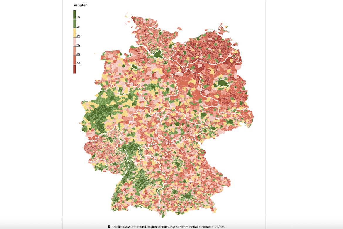
Der Spiegel, a German news magazine, has visualized how quickly residents can reach essential services on foot or by bike in German cities. Using data from the German Federal Institute for Research on Building, Urban Affairs, and Spatial Development, researchers divided inhabited areas of Germany into 100-by-100-meter cells and calculated how quickly people of different age groups could reach over 20 everyday destinations like food stores, schools, and healthcare. The map uses color scales, with dark green areas showing neighborhoods where services are very close (within 10 to 15 minutes) and deep red areas highlighting places where reaching basic needs takes far longer (an hour or more). The visualization highlights large gaps in eastern Germany, where residents must travel much farther to reach everyday services.
Mapping Accessibility of Services in German Cities
previous post

