
99
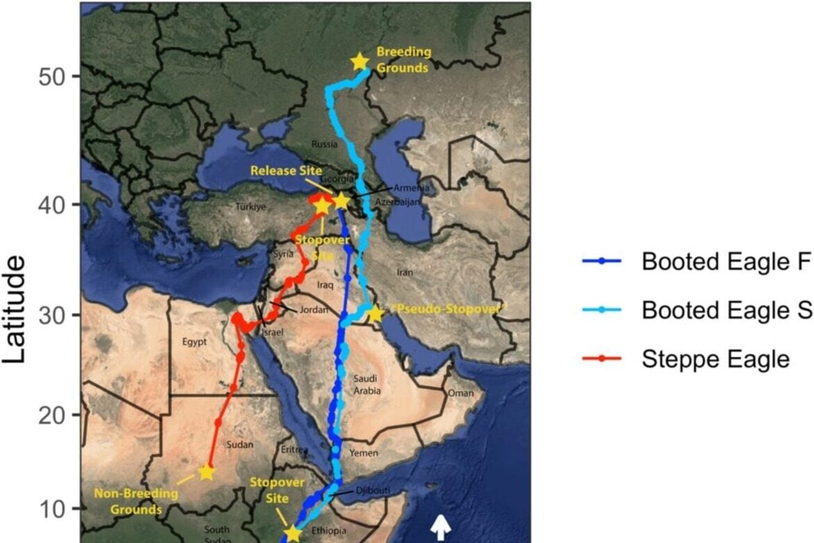
Researchers at the University of Utah have used satellite-tracking data to map migration routes of booted and steppe eagles along a major migration corridor between East Asia and Africa. The visualization aims to support conservation planning by identifying migration areas that need protection across more than 60 countries. The visual maps these patterns, with blue showing the booted eagle’s autumn route, cyan its spring return route, and red the steppe eagle’s fall route.


